The Bolund experiment is a field campaign that provides a dataset for validating models of flow in complex terrain. It has been the basis for a unique blind comparison of flow models. An increasing number of wind farms are being installed in complex terrain where wind resources are good, but the wind shear and turbulence can exceed the design basis. CFD is becoming a standard tool to quantify such wind conditions and determine the optimum positions of the wind turbines. However, these flow models have usually only been validated against wind tunnel experiments with simple terrain forms.
Description
The Bolund experiment is a measuring campaign performed in 2007 and 2008. The Bolund hill, though relatively small, has a geometrical shape that induces complex 3D flow. During the campaign, velocity and high frequency turbulence data were collected simultaneously from 35 anemometers distributed on 10 masts, thereby generating a large database designed to validate flow models.
Today, many models, designed to simulate flow in complex terrain, are evaluated against simple hill experiments performed at laboratory scales in wind tunnels. Such evaluation is convenient since boundary conditions are clearly defined. Despite the benefits of wind tunnel experiments, full scale field experiments are necessary in order to validate the numerical models at the correct atmospheric scales and with realistic terrain forms.
Probably the best known field experiment is that over the Askervein Hill. This is a 116m high, isolated hill with moderate slopes where an extensive field campaign was performed in 1982 and 1983. During the Askervein campaign, velocity and turbulence data were collected, providing a unique dataset for validating terrain flow models. Many, even linear models, have shown good results in reproducing the upwind and hill-top flow but often fail on the leeside where separation occurs. In complex terrain, especially where separation can be expected, the models have not been validated sufficiently. With both upstream and downstream separation, the Bolund dataset allows just such a validation.
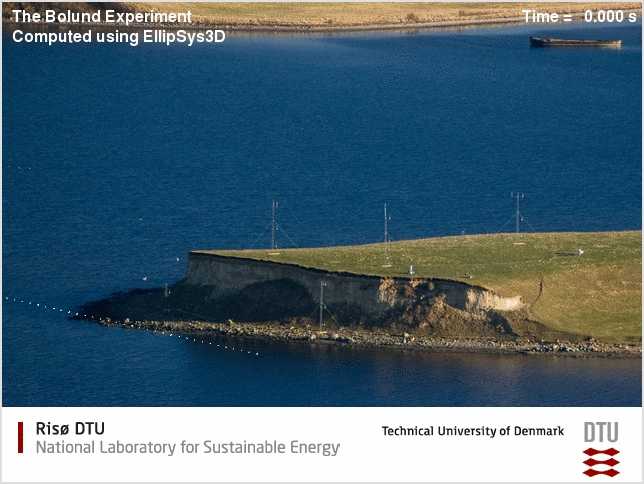
The figure above shows a model of flow in complex terrain.
One aim of the project is to assess the accuracy of models for flow in complex terrain. This has been achieved through a Blind Comparison where model predictions were compared with measured results. Modelers were challenged to predict the wind flow over the Bolund terrain based on the conditions of the free wind and the orography.
Publications on the experiment:
- Technical Report (Ris-R-1658.pdf)
- The Bolund Experiment, Part I: Flow over a steep, three-dimensional hill (2011). Boundary-Layer Meteorol. doi:10.1007/s10546-011-9636-y (open access)